Close this alert
Irish Historic Towns Atlas No. 23: Carlingford
Current price:
$78.00
Publication Date: June 25th, 2011
Publisher:
Royal Irish Academy
ISBN:
9781904890768
Pages:
36
Description
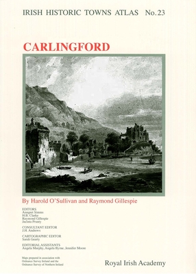
Irish Historic Towns Atlas, No. 23 details the topographical development of Carlingford, a port and fishing town at the gateway to south Ulster and north Leinster on Carlingford Lough. From its Anglo-Norman foundation, the picturesque town attracted many artists and travelers. Twenty maps and views are included, along with contemporary vignettes in the text section. A topographical gazetteer details c. 450 sites that contributed to the urban morphological development of Carlingford. This oversized, loose sheet pack, which also includes a fully searchable CD-ROM with high resolution maps and images for detailed examination, is part of the highly successful Irish Historic Towns Atlas series. The Irish Historic Towns Atlas project records the topographical development of a selection of Irish towns, both large and small.
Other Books in Series
Maps and texts: evaluating the Irish Historic Towns Atlas: Evaluating the Irish Historic Towns Atlas
Paperback
Georgian Belfast, 1750-1850: Maps, Buildings and Trades (Irish Historic Towns Atlas)
Hardcover
John Rocque's Dublin: a guide to the Georgian city: A Guide to the Georgian City (Irish Historic Towns Atlas)
Paperback
Irish Historic Towns Atlas No. 1: Kildare
Multiple copy pack
Irish Historic Towns Atlas No. 20: Tuam
Paperback
Irish Historic Towns Atlas No. 28: Galway
Paperback
Irish Historic Towns Atlas No. 29: Drogheda
Paperback
Drogheda c. 1180 to c. 1900: fortified boroughs to industrial port town: fortified boroughs to industrial port town (Irish Historic Towns Atlas)
Paperback
Irish Historic Towns Atlas No. 7: Maynooth
Multiple copy pack
Carrickfergus: Carrickfergus (Irish Historic Towns Atlas #2)
Multiple copy pack
Bandon: Bandon (Irish Historic Towns Atlas #3)
Multiple copy pack
Irish Historic Towns Atlas No. 13: Fethard
Multiple copy pack
Irish Historic Towns Atlas No. 12: Belfast, Part I, to 1840
Multiple copy pack
Irish Historic Towns Atlas No. 5: Mullingar
Multiple copy pack
Irish Historic Towns Atlas No. 4: Kells
Multiple copy pack
Limerick c. 840 to c. 1900: Viking longphort to Victorian city: Viking Longphort to Victorian City (Irish Historic Towns Atlas)
Paperback
Dublin 1610 to 1756: the making of the early modern city: The Making of the Early Modern City (Irish Historic Towns Atlas)
Paperback
Irish Historic Towns Atlas No. 22: Longford
Paperback
Irish Historic Towns Atlas No. 21: Limerick
Paperback
Reading the Maps: A Guide to the Irish Historic Towns Atlas
Paperback